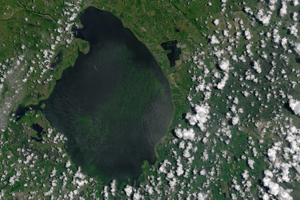
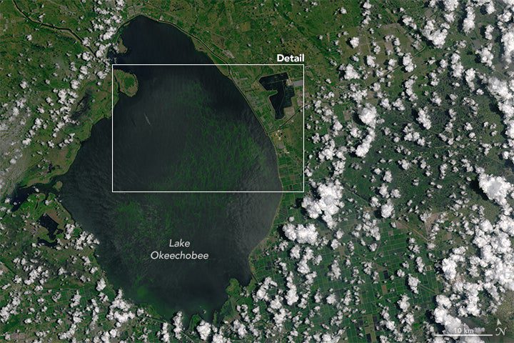
New satellite images show the growing extent of an enormous algal bloom in Southern Florida, causing a state of emergency in four counties.
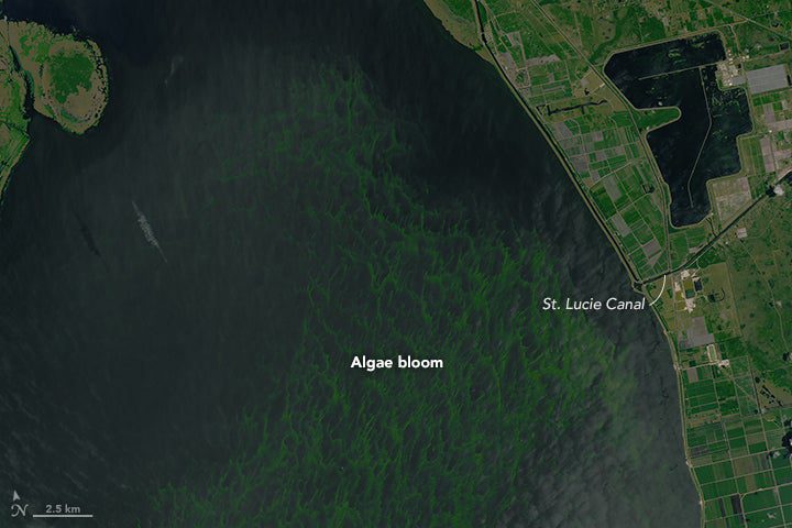
The images, taken by the Operational Land Imager on NASA’s Landsat 8 satellite, show Lake Okeechobee and the surrounding area from July 2, after the larger-than-average bloom had grown from 33 square miles in early May to an estimated 239 square miles.
This estimate by the Florida Oceanographic Society is a 500 percent increase over two months. The area is almost a third of the area of Lake Okeechobee, the second-largest lake in the contiguous United States.
Algal blooms are caused by a buildup of Nitrogen and Phosphorus in waterways, mostly from water runoff picking up nutrients while flowing over heavily fertilized land, like farms and golf courses. The nutrient increase causes algae to prosper. But with more algae, the water’s oxygen levels drop, and the algae release toxins that can kill off other aquatic life, like fish and plants. Toxins can also poison humans. Coming in contact with the water can cause nausea, vomiting and, in extreme cases, liver failure.
Scientists believe that Florida’s wet winter not only caused an increase in runoff, but also caused the spread of the algae and toxins, when state water managers started discharging water early this year through the St. Lucie Canal and out to the Atlantic Ocean near Stuart, Florida.
With the state of emergency declarations, Florida Governor Rick Scott has also asked the federal government for emergency funds. But some scientists believe that the governor and Floridians should not be surprised by the bloom.
“I’m a little bit tickled by our governor asking for this to be declared a federal disaster,” said Dale Gawlik, a biologist at Florida Atlantic University in Boca Raton, in an interview with New Scientist. “Scientists have been saying for decades, ‘we’ve got to clean up this water, and if you don’t these kinds of things can happen.'”
In more detail
Traveling out the St. Lucie Canal


